MapGO
(1)
Location Intelligence at Your Fingertips
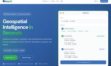
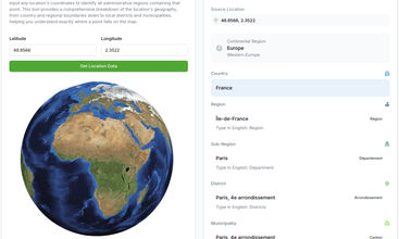
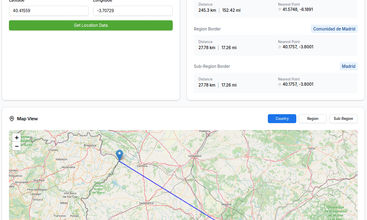

MapGO is a powerful geolocation tool designed for both users and developers. Easily identify countries, regions, and districts from coordinates, calculate distances to borders and coastlines, and analyze spatial relationships—all in one place.
For users, test it directly on our website with no setup required. For developers, integrate seamlessly using our API. MapGO simplifies location intelligence, making it accessible for casual explorers, businesses, and developers alike.
Share your take on this product
Comment
Write at least
50
characters. Specific feedback improves community quality.
No comments match your search.
Write at least
50
characters. Specific feedback improves community quality.
Trending Products
View allNo reviews match your search.
No team details yet.
Daily Winner
May 05, 2026

No active deals right now.